Island Masterplan
A competition proposal designed using a workflow developed with Rhino Grasshopper and a custom raytracing algorithm written in Python. The model takes the geometry of the site as an input and creates a variety of layouts by splitting the island into a series of distinct neighborhood enclaves produced through terracing of the landscape. These terraces ensure that as many parcels as possible have visual access to the island’s natural resources.
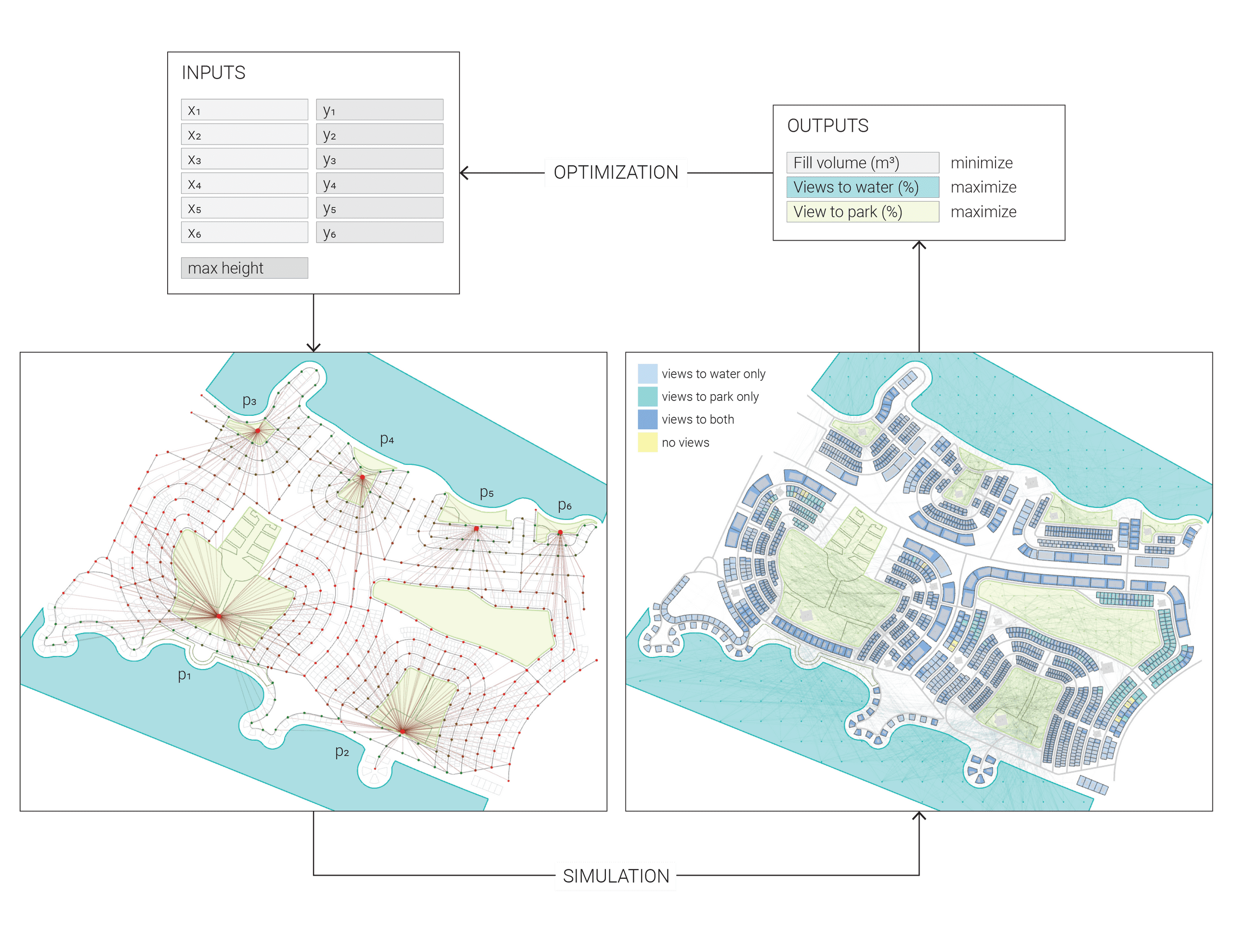
The computational model explores different variations of neighborhood arrangements and grading to optimize for the best views while minimize the total cost of the project
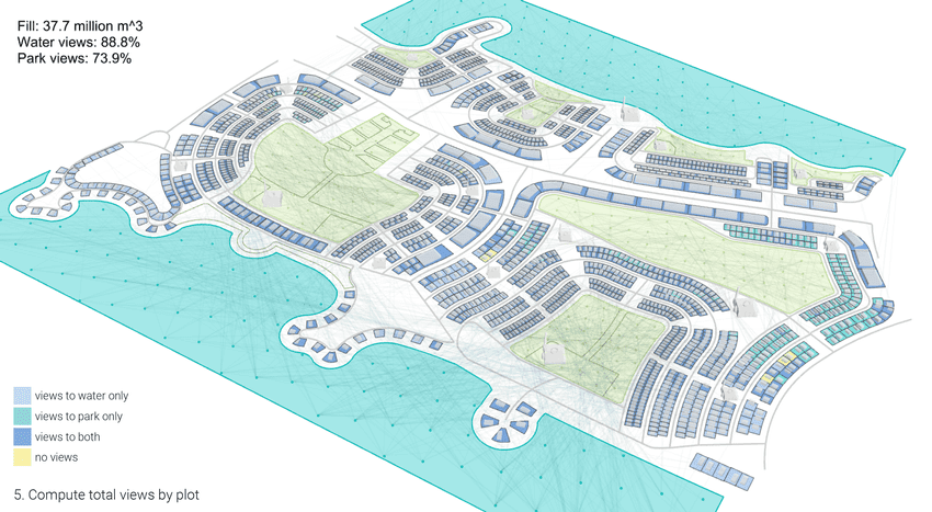
The task of the generative model is to figure out the minimal amount of landforming necessary to ensure a minimum percentage of parcels with unobstructed views to both the ocean and parks placed within each enclave.
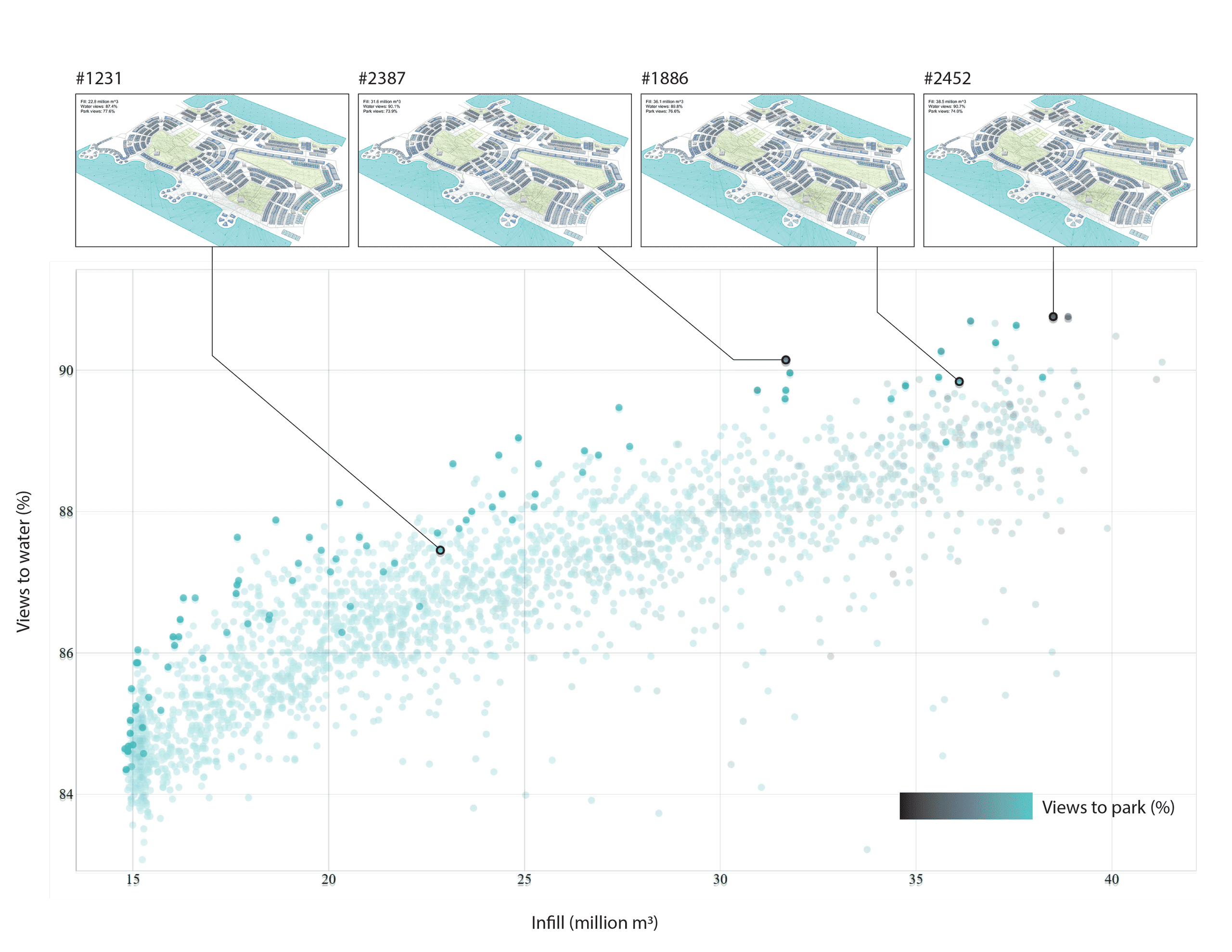
A large variety of possible options can be explored, each representing a unique tradeoff between minimizing the construction costs and creating the best possible views.
In order to give visual feedback to the user, the tool is able to automatically output the best possible views from each parcel to the closest public park and body of water.